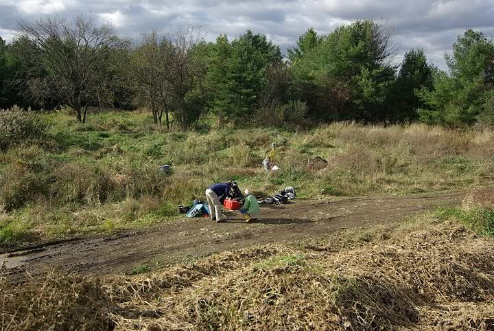
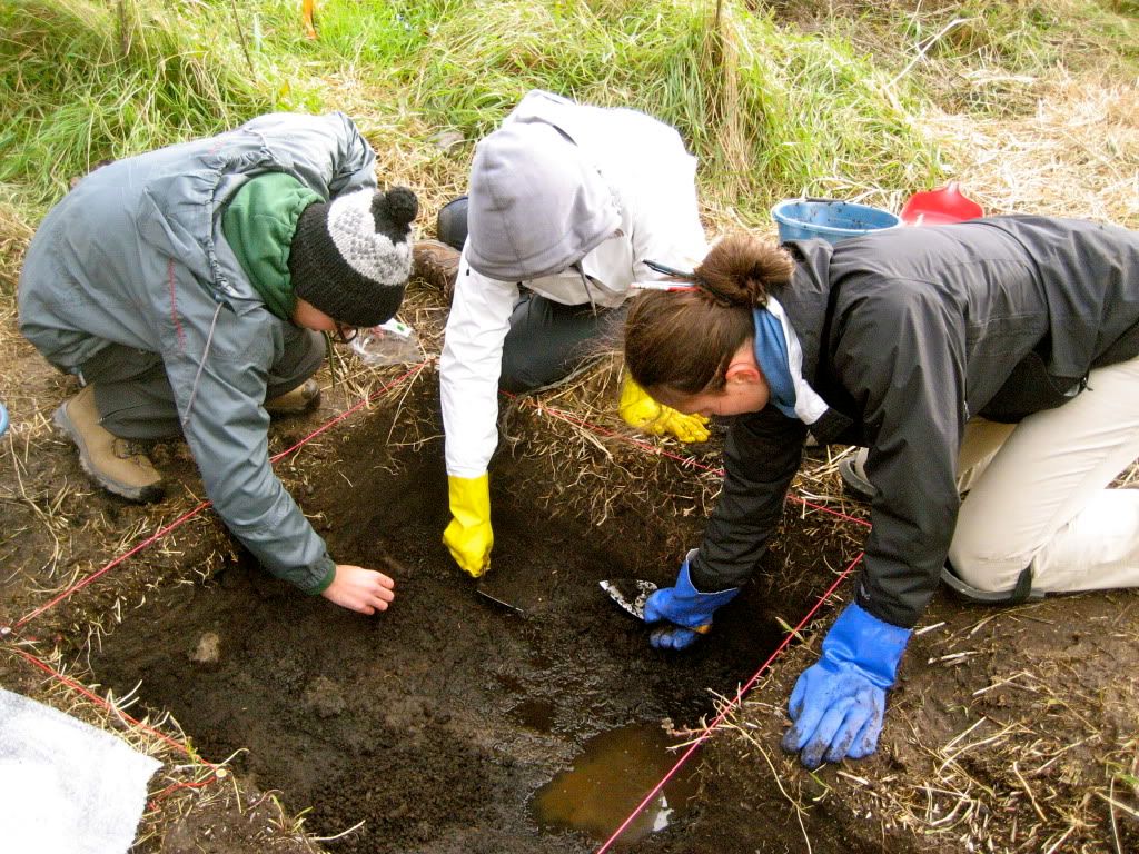
Sunday, December 5, 2010

Can we do better than Google?

If we were to file our Parc Safari data, would it go under "A" for "African Animals?" Or "Animals (African)"? Or maybe "Q" for "Quebec" (subsection "Africa")? Could the excavation of a zebra in Hemmingford, Quebec ever make a lick of sense without extensive context?


In 2004, a group of archaeologists met in a National Science Foundation-funded workshop to develop a concept that seems paradoxically fantastical and obvious: a centralized cyberinfrastructure, a working database of all archaeological data, ever, in the history of the world. Obvious because, as you the reader knows, all the most efficient organizational systems use online technology; fantastical because Keith Kintigh’s 2006 report on the workshop barely scratched the surface of the logistical nightmare that this theoretical database would be.


There’s a misconception among the Indiana Jones-loving masses that archaeology is a finite field, that almost everything to be dug up has been dug up, and that the whole discipline will one day go the way of the CD (that is, obsolescence). An understandable assumption, perhaps, when the only exposure one has had is a dusty black-and-white photo of the pitted, ravaged Valley of the Kings, but a very untrue assumption all the same. After all, as long as the world spins, things will get buried. As long as there is archaeology, there is new data. And as long as there is research, there is a very real need for easy access to old data.


In the information age, it seems easy to say, “well, let’s throw it online!” Surely after the database is designed and the bugs are exorcised, it will be a self-sustaining system, with all new information sliding neatly into its categories like books on a library shelf. And therein lies the first roadblock.


What is unique about archaeology is that data – the hard facts and the numbers – does not lose its importance, no matter how much new data is discovered. You can only excavate a site once (unless something has gone very wrong), and thus whoever got there first will be the effective data master forever. Even after the archaeologist’s death, new archaeologists will be referring back to those numbers and those pictures for as long as there is interest in that civilization. And since archaeology has existed in some form since the European Renaissance, the collective archaeological record is not only vast, but almost entirely in print.


And it is by no means enough to transcribe the data into electronic form. The ideal database is one that facilitates cross-referencing, which leads to the problem of standards. According to J.D. Richards’ From Anarchy to Good Practice, the documentation standards that exist now, adopted by archaeologists under pressure from libraries and museums of the world, are more guideline than law: “Guides to Good Practice, or Best Practice, but not Required Practice”. Without standards, the decisions you make on how narrow your animal categories will be (i.e. ungulates vs. artiodactyla vs. deer) or what side you support in the metric/imperial war will inevitably clash with the decisions of at least one of your colleagues, and researchers tend to panic when faced with a clash.


Richards goes on to question the real need for standards, using an example that very few people couldn't identify with: in the age of Google, we are all too used to the “type-and-hope” method of research; that is, plugging something into a search engine and praying that something at least mildly relevant comes back. And usually, it works. A truly standardized database would likely operate on a “point-and-click” basis, wherein the user would narrow down categories to find what he or she was looking for. Such a system that could comfortably accommodate all the vast and varied data accumulated over decades would have to be detailed to the point of inscrutability. To simplify the system bears the risk of shuffling aside inconvenient data that refuses to fall neatly into a category. The designers of this database would be walking a very, very thin line. The "Metadata" (the details of how a database is arranged) would have to be very controlled to avoid the comedy cliché of the filing system that, in a quest for maximum efficiency, has become too detailed to be at all useable.


During our discussion, the point was made that, once the database is in wide use, it puts pressure on academics to publish quickly. It would be difficult to take one’s sweet time in writing a dissertation when eager colleagues could easily access your data and begin their own inquiries. It also raises new ethical questions concerning the importance of disclosure in a new age of instant data-sharing.


The website “tDAR” (the Digital Archaeological Record) is the first attempt at a realization of the theoretical database. It is quite new and displays this not-exactly-inspiring disclaimer above the search bar:


“As this is a beta release, we will appreciate your tolerance of any problems you encounter and encourage you to send comments, suggestions and bug reports to [address].”


Out of curiosity, this humble blogger entered “tiwanaku” into the search bar, reasoning that surely the name of such an important site would return a wealth of information. I must say, I was mildly shocked when only a single result appeared. Either the young tDAR is not looking to pressure archaeologists into contributing, or there is a resounding lack of interest from the wider community. Either way, at this point, this isn’t the database we’re looking for. (We don’t need to see its identification. We can go about our business. Move along.)


Despite all this, both the NSF-funded forum and Roberts are convinced of the need for a database. To them, the benefits outweigh the risk. As a student of archaeology who is quite often fed up with the existing online resources, I do hope their vision becomes reality sooner rather than later.


Kintigh, Keith. "The Promise and Challenge of Archaeological Data Integration." American Antiquity 71.3 (2006): 567-578. Web. 11/05/10.

Richards, J.D. (2009) From anarchy to good practice: the evolution of standards in archaeological computing. Archeologia e Calcolatori, 20 . pp. 27-35.

Wednesday, November 24, 2010

The Good, The Bad and The Muddy: Ethics for Archaeologists.

To conclude the educational odyssey that has been this class, we discussed the complex issue of ethics in archaeology. This semester we have learned how to identify, plan, map and execute a successful archaeological excavation, so it seems fitting that our field season comes to close with a discussion about ethics behaviour and professionalism. While ethics are important in any professional discipline, in archaeology ethics are essential because we frequently require access to sensitive cultural material, like human remains, around which issues like ownership and preservation revolve.

Bergman and Doershuk define ethics as “what is good and bad and what compromises moral duty and obligation” (2003, 86). We expanded this definition and decided that for an archaeologist, ethical behaviour is to identify the potential stakeholders involved, their mandates and cooperate with them while still achieving the research goal. We determined that at any one time there are at least three stakeholders involved, the archaeologist, the landowner (whether it be the federal government or a private owner) and the descendent group. In Cultural resource management the client also has a significant stake. As a result, to act ethically one must take into consideration the interests of all the stakeholders involved.

For an archaeologist, the primary objective of an excavation is to obtain as much information about a site as possible, while operating within the law and cooperating with other stakeholder interests. Archaeologists are often ascribed the identity of being “stewards of the archaeological record” (Groarcke and Warrick, 2006, 165) we preserve it, interpret it and can make accessible to the greater public. Does this make our interests more important than those of the other stakeholders? Here in lies the challenge. Whose interests matter more? Does research take precedence over site preservation? Should the wishes of descendent group be more important then those of the landowner? Should all stakeholders be equal? There is no easy answer; yet each excavation team will have to take some form of action.

Ethics are also significant when extracting value from archaeological data. Oral histories from a descent group could contextualize data in way that academic deductions could not. Alternatively, the academic record can identify inaccuracies in the oral history. The oral history of Parc Safari is a good example. Although the site is less than thirty years old, discrepancies have been discovered between the oral history and the material we have excavated. If there is a conflict in interpretation, whose story is chosen as correct?

We also discussed the importance of avoiding biases and considering alternative opinions when interpreting archaeological data. Even within the same stakeholder group differences of opinion can exist. We discussed the divisions between academic and Cultural resource management (CRM) (Bergman and Doershuk 2003,1). CRM archaeological consulting is a relatively new development in the field of archaeology that is concerned with extracting archaeological data as a business. The difference between CRM and academic archaeology is that CRM is conducted to assess cultural remains within sites designated for future development. The result can be a salvage excavation to extract data from a site before potentially damaging construction or development takes place. The data derived from archaeological consulting has, in the past, been deemed as “grey literature”(and has been regarded as less important than the data from academic archaeological research). We discussed the possibility of using grey literature as a source of information for future academic research. Grey literature is a valuable resource, encouraging its use in academia could assist in discouraging the endurance of negative professional stereotypes.

We concluded our discussion by determining that archaeologists of any profession have an obligation to engage neutrally, preferably in the political arena where all stakeholders’ voices can be heard. It is important to remember that the archaeological record is publicly owned; because archaeologists have the privilege of first contact with the archaeological record there is substantial pressure to ensure that our choices and actions comply with the accepted ethical standards of the time. And let’s be honest, complying with ethical standards is a small price to pay for the fun of getting dirty in an excavation pit.


Works Cited:

Bergman, C.A & J.F Doershuk, 2003. Cultural Resource Management and the Business of Archaeology. In Ethical Issues in Archaeology, edited by L.J Zimmerman, K.D Vitelli, and J. Holloway-Zimmer, 85-98. New York: Altamira Press.

Groarke L. and G. Warrick, 2006. Stewardship gone astray? Ethics and the SAA. In The Ethics of Archaeology: philosophical perspectives on the archaeological practice, edited by C. Scarre and G. Scarre, 163-177. Cambridge: Cambridge University Press.

Wednesday, November 17, 2010

Digitize This!! (oh wait, i already did)

Since our days in the field have unfortunately come to an end, Parc Safari 2010 has begun the process of discussing the possibilities of digital archaeology. As a group, we came to the consensus that in order for digital archives to be legible, standards must be applied to allow for comparability. Furthermore, metadatas must be created to facilitate useful comparisons based on ontologies. Our discussion this week turned to the effect of new technologies on field methods. While these technologies do allow for increased data acquisition, they must be taken up with a grain of salt.

It is fitting that during our discussion of the uses of technology in archaeology we should find ourselves with a perfect example of technology as a hindrance. Corroborating Backhouse’s claim “digital data is almost always useless because it generally has no contextual information with it”, the data points recorded by the total station lost some of their significance due to a misinterpretation of context (Backhouse 2006, 53). In order to understand this example, we need to go back in time to Parc Safari, week 8: after setting up the total station over our datum, a tedious process of leveling then adjusting then leveling again, we realized that our labour had been in vain because the stick on which the total station prism is mounted had been forgotten. Luckily, the total station is a technology designed to be adaptable; instead of using the prism to locate data points, a laser can be aimed directly at points to record their location. Since we had already plotted the location of each corner of PSTR1, we could use one of these corners for a temporary datum. This is where the problem came in: we knew that PSTR1 comprised of points 12,13,14,15 but we had not recorded in our notebooks the location of each of these points. So we made the assumption (which turned out to be incorrect) that the points must have been taken in either a counter-clockwise or clockwise manner, such that the northwest corner of PSTR1 would always be point 14. We then continued to plot all of the points for week 8 from point 14, which was actually the southwest corner of PSTR1. The result when Colin mapped the total station points of PSTR1 was a crooked map. In this way, our data suffered because we failed to record its context.


Total Station at northwest corner of PS2010TR1

Another limitation of digital archaeology is apparent in this example: that of digital maps. As Zubrow points out, the perceived reality of digital maps are often greater than is justified (Zubrow 2006, 22). Since our skewed map of PSTR1 is constructed of data points plotted by a sophisticated technology, somebody not involved in the project may view it as a completely accurate depiction. Unlike hand-drawn maps, which show the hand of the artist who produced them, digital maps have the appearance of being a “disembodied view from nowhere” (Zubrow 2006, 22). In reality, however, (like hand-drawn maps) digital maps “are located in culture, space and time” (Zubrow 2006, 22).


Map of PS2010TR1

Despite these limitations digital maps, and digital archaeology in general, provide useful tools for the archaeologist. As Chris pointed out, a hand-drawn map cannot be published in a paper thus necessitating its conversion to a digitized form. Not only does this conversion take time, it also “removes the data one more step away from the individual who made the observations in the first place. An interpretation on site recorded on paper is reinterpreted in post-excavation, introducing data irrelevance and data inaccuracy” (Backhouse 2006, 53). Furthermore, digitizing these maps allows a degree of play with archaeological data. In Bevan and Conolly’s survey of Kythera, Greece, for example, maps of terrain at multiple scales were layered over one another – a technique only made possible with GIS (2004, 132). By creating a mult-scalar map Bevan and Conolly were able to determine terrain curvature. In other words, which valleys appear as valleys at multiple scales? In a somewhat dated article, Dibble and McPherron seem to prophecy Bevan and Conolly’s approach when they write: “the fact is that we can and will explore more possible relationships when data manipulation is made much easier” (1989, 437). Since the possible questions an archaeologist can ask are increased by digital archaeology, “digital developments create or at least influence the creation of theory” (Zubrow 2006, 11).

The use of technology in archaeology offers more efficient, more sophisticated, and faster methods for use in data acquisition, analysis and archiving. Some of these possibilities have been described here. It is important to remember that without standards for recording such data it can become a drop of water in the ocean that is the archaeological record. It is also significant to acknowledge the effect that these new methodologies can have on archaeological theory.

Works Cited: Backhouse, P. 2006. “Drowning in Data? Digital data in a British contracting unit”. In: Daly, P. and Thomas L. Evans (eds.), Digital Archaeology – Bridging Theory and Method. New York: Routledge, pp. 50-59

Bevan, A. and J. Conolly. 2004. GIS, Archaeological Survey, and Landscape Archaeology on the Island of Kythera, Greece. Journal of Field Archaeology 29, 123-138.

Dibble, H.L. and S.P. McPherron. 1989. On the Computerization of Archaeological Projects. Journal of Field Archaeology 15, 431-440.

Zubrow, E.B.W. 2006. In: Daly, P. and Thomas L. Evans (eds.), Digital Archaeology – Bridging Theory and Method. New York: Routledge, pp. 10-33.

Wednesday, November 3, 2010

Packing it in. Or, how to excavate TR2 in one afternoon.

Last Friday was our last day in the field. The occasion brought the two groups together, produced several finds, and created a general excitement as we collectively tried to get as much done as we could before we packed it in for the term. As we worked quickly under a slightly overcast sky and brisk weather, we were very aware of the time constraint—as Chris and Colin put it, everything that we did that day needed to be finished. That day.

This week the group split up to maximize our time at the site and the first task at hand was to continue exposing the extended portion of our first trench (PS2010 TR1) since Group A had further exposed portions of several bones. Several bones were unearthed, including a rather large, short, and squat femur which soon became one of the biggest finds of the day.


At the same time, we continued test the subsurface deposits between our first trench (PS2010 TR1) and the Watusi unit, using the same method described in last week’s blog post—a simple and inexpensive coring device. As previously mentioned, we do not yet have a clear idea of the stratigraphy of all areas of the site since many of the layers have been disturbed by the construction of the road. The Parc Safari site was thus a good place to get an idea of the three-dimensional matrix of an archaeological site: most of the site consists of sediment and soil deposits (most of them anthropogenic, or altered by human activity) or constructions (the road), with scant artifacts. While it is largely an additive deposit, consisting of the various layers of animal burials and deposited refuse, there is a considerable amount of deposit subtraction that has occurred through the construction of the road (Kvamme 2005, 425). This post-depositional disturbance accounts for the mixed surface finds that we encountered in our trenches, close to the road.


The crew took turns coring, finding a similar stratigraphy to what had been encountered in the Watusi Pit. Making our way slightly northeast to TR1, we took several samples and found the same thing each time: past the top layer of vegetation there was (1) a loose organic layer, with some roots and grass, (2) a more densely packed layer of soil, and (3) a final layer somewhere between the dirt and clay.

One last core was left, close to TR1, and it was my turn to have a go. It was a bit tougher than I thought it would be, but after briefly contemplating jumping on the handles and treating it like a pogo stick, I gave it one last good shove and in the ground it went. This one was slightly different. After the topsoil there was simply the loosely packed organic layer and the more densely packed layer of soil—so now we have an idea of where the stratigraphy changes in that portion of the site.


To get a better idea of the subsurface deposits, next year’s team may be able to use the brand-spanking new Ground Penetrating Radar (see previous post); however, this year it was not at our disposal. We did have one last project at hand, though—as we were simultaneously continuing to excavate/map TR1 and coring, we began and completed our second trench, PS2010 TR2.


The location of this second 50cm x 2m trench was determined by a hypothesis that Chris and Colin had about the mapping of methane emissions by the geography department. If the methane emissions could be proven to be higher near units that contained bone, then there might be a correlation between the methane level in the soil and animal remains, thus allowing us to include chemical mapping in our arsenal of terrestrial remote sensing techniques.


Chris and Colin seemed to be on to something, and we eagerly excavated the unit next to Peeper 3. Being careful to follow the Golden Rules, we unearthed an array of individual bones, including a tailbone in the southwest portion of the trench. After carefully mapping in our finds, our instructors nearly had to pull us away from our trowels to pack up. It appears as if you really do find everything on the last day…


That lion will have to wait for next year.


Kvamme, K. 2005. Terrestrial Remote Sensing in Archaeology. In: Maschner, H.D.G., Chippindale, C. (Eds.), Handbook of Archaeological Methods. Lanham, MD: AltaMira Press, pp. 423-77.

Roskams, S. 2001. Excavation. Cambridge: Cambridge University Press.

Stein, J.K., 1986. Coring Archaeological Sites. American Antiquity 51, 505-527.

Wednesday, October 27, 2010

Coring & Augering


Generally, my opinion of the Park Safari and its excavators is that we are all a rugged bunch. We dutifully and energetically attend to our trench as we did our first test pits.

But say we were not able to dig our systematic test pits and were unaware of the basic stratigraphy of the site- what then? There are a variety of other methods used to examine the innards of a site without actual excavation, saving both cost and time.

First and most simply are the techniques of augering and coring. These methods originated in the geology when it was used to understand the fluvial deposits in the Mississippian Delta region in 1935 (Stein 1986, 506). Once applied to archaeology in the same region, it was used to discern cultural from non-cultural deposits in an area of interest as well as compared to the geological findings to establish a relative chronology. Following the advent of radiocarbon dating, coring and augering became more of a resource for gathering testable material below the surface.

Augering is the more destructive of the two, requiring a drill of varying sizes bored into the ground and returning the soils from below. It can pull up in bucket sized increments the layers which it has disturbed, but they are by no means intact and sufficient for accurate study. To penetrate to large depths of several meters a motorized drill is often used to power the auger.

Alternatively coring involves small tubes- about 3cm in diameter- to be pushed into the ground at predetermined depth intervals and shaken forth to pull up a sliver, albeit a compacted one, of earth representing the stratigraphy of the ground below. It is officially defined by Stein as “a continuous section of sediment or rock obtained by using a hollow cylinder called a corer” (1986, 505). If to be used with radiocarbon or chemical testing, this sample preserves more accurately the layers below.

Similarly, soil testing is common practice in locating indications of human activity; phosphate testing is used to locate where the original chemistry of an area has been disturbed by either fire pits or concentrations of human activity, as when nutrients are removed from the soil by activity, or added in with refuse decomposition (Roskams, 55). At Park Safari we based the site of the trench (PS2010TR-1) on readings taken from the methane peepers set up by the McGill Geology department.

If we were completely unaware of the stratigraphy at the Park Safari graveyard, coring would act as an inexpensive and expedient method for understanding the layers we would encounter upon digging: these would be the organic layer, the mineral layer, and then the yellowish clay layer indicating artifact sterility. Were we to come upon a deposited layer, or animal remains, it would indicate a ‘cultural’ layer, which would then be plotted to a map for overall reference. Our overall picture of the graveyard, however, is severely lacking; there are no known burial sites except for those which have already been uncovered and in the middle of the western field stands what believed to be an old structure and our only indications are from the methane emission readings. A systematized augering test done at intervals through the mounds and vegetation would illuminate concentrations of articulated or non-articulated bones, therefore grave sites (like of lions).

In the last few decades a range of machines have been developed that create images of the sub-surface, blasting far beyond the WWII era aerial photography techniques of mapping. As they lay far beyond our budget, I include only a most special machine in this short post: Ground Penetrating Radar (GPR). The cause of a local stir both within and without the department of Anthropology, a newly acquired (or currently being acquired, depending on tense implications, and $$ allocations) GPR machine. In simple terms, GPR functions by sending microwave pulses (300-500MHz) below the surface, and creates an image based on velocity reduction of the wave once it has passed through a denser object (Kvamme 2005, 436-7). This method is highly depended on soil types and water content; our flooded trench, for example, would indicate we stand upon a rocky pond. On some days, indeed this is what I’ve come to believe too. But there is a lion in there somewhere.

Kvamme, K. 2005. Terrestrial Remote Sensing in Archaeology. In: Maschner, H.D.G., Chippindale, C. (Eds.), Handbook of Archaeological Methods. Lanham, MD: AltaMira Press, pp. 423-77.

Roskams, S. 2001. Excavation. Cambridge: Cambridge University Press.

Stein, J.K., 1986. Coring Archaeological Sites. American Antiquity 51, 505-527.

Wednesday, October 20, 2010

Lions and Curses and Nazis, oh my!

parc S stormabrewin
Can you see that storm a brewin'?


Archaeologists deal with some pretty dramatic circumstances. According to a History Channel documentary I happen to own, we are constantly in danger of noxious gases, earthquakes, attacks by local landowners, curses and Nazi’s. I couldn’t make this stuff up if I tried. These may be legitimate worries though, since I too feel like I’ve finally earned my archaeologist’s fedora. For the last few weeks, we at Parc Safari have had to deal with the worst of the worst. We have had (gasp) inclement weather.


All joking aside, the weather has actually been pretty poor in Montreal of late. And apart from making my teeth chatter and my llama-wool socks wet, the rain has been a bit of a problem on site. In fact, only last week group B was forced to come home in the middle of a field day, despite Chris and Colin’s promises that we (like the US Postal Service) would not be deterred by rain nor snow nor sleet.


It is an unfortunate fact that excavation relies heavily on our ability as field workers to actually see the unit. When the weather is poor, the rain poses some problems. What my fellow students and I recently realized is that rain makes the soil deposits wet (an incredible revelation, I know). This made using a flow diagram, such as the one we were given (to determine the composition of deposits) more difficult. It was harder to differentiate between layers by colour for instance. What I mistook for a change in stratigraphy turned out to be what Colin called a “tub ring”. The rising water table and rainwater left a ring of discolouration on the walls of the unit after we finished bailing.


On the other hand, the rain would have been fortuitous if we had we been using a Munsell chart to determine colour. This is because the rain would have "moistening it until it no longer darkened" which is the proper technique for Munsell. Unfortunately our Munsell chart chips are not waterproof making them useless in the rain. In better conditions a field worker is expected to record not only the colour and soil type (which we tried to do) but also the inclusion size and surface details of each stratigraphic layer (Roskams 2010). We did not make note of the inclusion size but we did, as I will discuss later, map in ‘surface details’.


On a side note: an interesting fact I learned through the readings is the difference between soil and deposit. Soil is created in situ, if you will, by organic means whereas a deposit is brought into it's current location via natural forces like flooding and erosion or by human means (Roskams 2010), such is the case for Parc Safaric where backhoes and large machinery were likely used. But I digress...


Wet weather, along with a high water table also made it difficult to excavate. Not only were the sides of the unit highly unstable but seeing the bottom of the unit was near impossible for group B. According to Colin they could not bail fast enough to keep a dry bottom. I think underwater salvage archaeology is incredibly interesting, but that’s not what we are supposed to be doing here at Parc Safari!


Thankfully, all was not lost. We were not going to throw in the metaphorical trowel. We were better than that as archaeologists, gosh darn it! Given that group B could not actually excavate, they retreated honorably into drier conditions for a lab-style lesson. We in group A managed to practice a few skills that didn’t involve digging too much deeper. Since we uncovered a few more bones (including what is part of an axis) and rocks it was decided that drawing the unit was the next step. Interestingly, we also uncovered a large embedded piece of heavy-duty metal cord.


Chris and Colin led us in a quick lesson on how to draw and map a unit. I have had plenty of practice on mapping, from my field school this summer but only in the base-line drawing method. Chris and Colin proposed three alternative ways to map a site or unit.


  1. Hip chains

This method involves using a forestry tool called a hip chain. It is a biodegradable rope material that is released from a canister hung off of a person’s hip. Like a pedometer, hip chains measure distance, though in metric terms instead of steps to help an archaeologist map a large unit or entire site.

  1. Triangulation

This method is used to determine the location of a point by measuring angles to it, from known points at either end of a fixed baseline, rather than measuring distances to the point directly. To use this method you anchor your two tapes at known points (in our case the corners of a unit). Then you level them with line levels and you measure the distance of each to the object. You record this. Then you scale the measured distances with a compass and draw circle segments; the point where your segments intersect is where your new previously unknown point is. Plot this on lattice graph paper.

  1. Drawing screen

This method is very useful for smaller units or those that have a large quantity of material to draw. It involves putting a physical screen over the unit, which corresponds to a metric grid system and plotting the results on lattice graph paper.


The method we used on Friday was the base-line method of drawing. A ‘base line’ is set up along one axis of the unit, using a tape measure along the string. A second tape measure is used to ‘eye-ball’ a point (on a bone, interesting feature etc) that you want to draw, and the distance from the baseline is used. Often a plumb-bob is used for deeper units to help with the estimating. The coordinates are then called out to someone who has a scaled map set up on lattice graph paper and the points are plotted.


Photobucket
He's down there somewhere...


Weather is something we as archaeologists have no control over. We can pray to the (undead) spirit of Lewis Binford all we want but sometimes the day just turns out soggy. We are a resilient type of academic, willing to brave the elements, but we are also bright enough to know when to pack it in. No, we have not found lion yet. I want to believe he’s there though, waiting in our watery unit, biding his time.


Wednesday, October 13, 2010

RESPECTING THE RULES

 After digging a number  of inconclusive tests pits over the past two weeks, we were running out of time ( the deep cold of Quebec slowly approaching).  So, Chris and Colin had to intervene in order for the project to get back on track! To help us find something, they asked the biologists (who are conducting a study of the methane level contained in the soil at the site) if they had any insight . They told them that based on a number of sample spots scattered around the (West side of the road) two of them (#3 & #5)  showed interesting results. Both had a very high level of methane which increased as investigation went  deeper contrary to the other sample which sustained  a constant reading throughout the probe.  Biologist suggested that it could be an indication for the presence of bones. This meant that we now had a new potential location to explore !

So the goal of the day was to dig a trench!  & Hopefully find some BONES

We decided to dig a 2m x 50cm trench (PS2010 TR1) in order to  get a more extensive knowledge of the underground.The down side, of this method is that if by any chance we were to hit  something  we would probably not get a full individual due to the narrowness of the unit. In this case, we would dig a larger trench.

But before we could start digging we had to: clear the vegetation in order to set up the unit and have enough space to dig.

Once this was done we were finally ready to DIG !!!

 But we had to keep in mine the   Golden rules of excavation:

1) DO NOT dig, EXPOSE!                                        This means that we MUST NOT pull anything out of the unit, roots, rock, artifacts but rather expose them (scrape around) and the remove them. When exposing, scrape away from the walls and remove the dirt as we go. (Roskams, 2001, 228)

2) Keep the unit leveled at all times.

3) Keep the unit wall straight and vertical


Roskams argues for  the screening of the soil in order  to uncover small artifact(Roskams, 200, 222).But since we do not have a lot of time and we are especially looking for large bones we will not be using this method when excavating, instead  we will make a pile of  unscreened soil in order to back fil the unit at the end of the season.

After digging for about 20 minutes we made our first find: a feline claw. It was a good start, at least compare to the previous weeks we were finding  something!  A large concentration of toe bones were also uncovered the majority of them coming from the West end of the unit.      We started questioning the fact that we would find only toe bones in the loose surface. Why is that so ? (the only speculation that we were able to make was that the big Cat was buried on his back : ) )

Care was taken to keep the walls of our unit straight at all time but  it was more difficult than imagined since it had rain for the past week making the ground very soft and our walls unstable.

About 10 centimeter below the surface we started witnessing some type of silvery material at the centre of the unit, so we started scrapping around in order to uncovered it ( The # 1 rule when excavating is to expose and not to pull out anything until it is not totally uncovered) So since we are professionals this is what we did and finally after completely exposing it, we were  excited to discover that it   was a pull tab  Budweiser beer  can probably dating from the 1970s-or 1980s. In his article Glassow discusses the excavation of such “site’s depositional history”, the organic or inorganic remains left at the site by  past occupant, and the fact that they can enable us to date the site (Glassow,2005, 158-159).

After uncovering this artifact we realized that our unit was not leveled anymore. (The rule #3 in excavating, archeologist need to keep there unit leveled at all times) It was lower on the West side than not the East side. Even though this task seems simple it becomes very challenging when 6 persons are digging in such a small trench!  So we started to dig deeper in the East side of the unit and we made the find of the Day!

In the South-east corner of the trench we found part of an articulated leg of a large animal.  Even though, we got really excited and wanted to take the bones out in order to i.d. them we had to restrain ourselves and respect the Number 1 rule: Exposing.  While Karen and I were exposing the bones, the other girls  went to setup up the total station in order to map them. Once mapped, we were able to remove some of the bones but two large ones were stuck in the south and east wall of the unit. The last find of the day was a small scapula near the south wall  in the centre of the unit.

This was conclusive day since we finally found some bones! But we have to keep in mind that archeology is science and that while excavating the Golden Rules need to be respected at all times.


Work sited:

Glassow, M.A. 2005. Excavation. In: Maschner, H.D.G., Chippindale, C. (Eds.), Handbook of Archeological Methods. Lanham, MD: AltaMira Press, pp.133-75.

Roskams, S. 2001. Excavation. Cambridge: Cambrifge University Press.

Tuesday, October 5, 2010

“If only it were like Indiana Jones!” or Meditation on the fact that archaeology is inevitably slow but worth it in the end


(EDIT I was just recently informed that Group B uncovered some exciting remains this past Friday, October 1. So please keep in mind that when I had written my entry we hadn’t found anything yet! merci)

Every aspiring archaeologist almost certainly must confront the unfortunate truth that the archaeological process is rarely as it is portrayed in film and adventure shows. We all hope to discover that coveted research find, whether it be a pharaoh’s tomb, a mythical lost city, or a seemingly trivial ceramic fragment. For us budding excavators at Parc Safari, our search this past week continued for the supposedly bountiful animal bones. When I had first heard about the abundance of animal remains at the site, I had a series of fanciful imaginings of us excavators practically tripping over gargantuan ribs and femurs jutting from the ground. However, after we had begun excavating, the site became more and more in my mind simply the abandoned overgrown field it ostensibly is, void of any noteworthy archaeological remains. Of course this is not the case, but my dubiousness illustrates that the archaeological method is a slow, often painstaking process, one in which your desired finds will rarely present themselves conveniently within the first few days of excavation.

Last Friday, September 24th at Parc Safari consisted of digging more test pits in order to determine the location of our future excavation unit. As Glassow maintains, test pits are integral to the archaeological process, as they provide the archaeologist with a basic understanding of stratigraphy, as well as an opportunity to come across some material remains like bone or artefacts (Glassow 144). Such finds of late in our test pits included, as Dominique mentioned, the Parc Safari “garbage,” providing evidence that dead animals were not the only materials deposited at the site. A more promising find, one that is directly related to our research focus of finding animal remains, is the retrieval of red rope, which according to Parc Safari staff was used to bind the dead animals prior to their burial at the site.

Upon reaching bedrock, we evened out the sides of the test pit, and proceeded to map out the distinct layers of soil, as well as including any features such as rocks, garbage, or the prized “red rope.” Drawing profiles is more an art than a science – final drawings of test pit profiles necessarily seem to be simplifications, as the layers of soil will rarely be as clearly defined as they are rendered in drawn form. That being said, this perceived lack of difference is inevitable given my considerable lack of expertise concerning soil types; profile mapping requires a level familiarity, achieved only through experience, through which we become more perceptive of such subtle differences. To the unfamiliar eye, things tend to look the same.

Archaeology demands the dedication of the excavator. Our experiences at Parc Safari have further highlighted the fact that, even though we know there are animal bones on the site, the locating of such remains is far from a straightforward task. Although the going is slow, archaeology is rarely unrewarding in the end. I remember for the first time uncovering a cache of ceramic fragments at the top of a Mayan structure in Belize this past summer, and suddenly every source of pain, bother, and frustration was rendered entirely insignificant: the deathly mosquitoes, the suffocating humidity, the trowel and shovel blisters. Fortunately, as humans, we are able to selectively remember and conveniently forget. This capability for me transformed a largely arduous ordeal (upon reflection) into a rewarding, enriching experience. As evidenced by our progress at Parc Safari so far this semester, archaeology is slow and labour-intensive. But it is in the end, I think, well worth it.

Works Cited:

Glassow, M.A. 2005. Excavation. In: Handbook of Archaeological Methods. Eds Maschner H.D.G., Chippindale, C. Lanham, MD: AltaMira Press.

Wednesday, September 29, 2010

"Find Us the Lion"


"Find us the lion." At the unset of this year’s Field Course, this (half-joke?) request seemed simple enough to the innocent and ignorant students that we were. After field walking and a first round of test pitting, the cruel reality came crashing down on us: knowing it’s there and actually finding it are two, very distinct things, at the heart of the archaeological problem. Whether relying on the vague memories of senior Park employees or on trade records millenniums old, archaeologists are constantly faced with the problem of finding ― in a more or less vast landscape ― the remains of things past.

Through survey, general areas can be delimited, but there again, vegetation, terrain or simply the cruel yet unstoppable passage of time can hinder our best efforts. The thriving vegetation and uneven terrain of the old Park Safari cemetery offer a concrete example, in which the field walking techniques we implemented may not have been the most appropriate. In any which case, surveying is often the first step taken in an archaeological project, for it may reveal the presence of sites or simply delineate areas of interest. What scanty results we did came up with, coupled with accumulated knowledge about the site and a desire to answer some questions concerning specific areas gave us a general portion in which to conduct test pitting.

Despite some promising results composed of “Park Safari garbage”, the remains of the lion, or any other animal for that matter, were still eluding us. Since the aim of this project is the study of mass graves, and not of the disposal patterns of Park Safari garbage, all those ropes, twines and plastic labels were of little interest for the opening of a proper trench if they didn’t came with the bones we’re ultimately after (Glassow 2005:137). In that regard, some more test pits had to be dug, which is what we devoted ourselves to on September 24th.

Armed with our pointed shovels, which seemed very appropriate given the thickness of the organic layer and the general nature of the soil (Glassow 2005:140), we conducted a “targeted search” in the north-western portion of the site. Through this small-unit testing, defined as the excavation of an area too small to actually enter (Glassow 2005:144), we intended to establish the nature of the deposits below our feet, in addition to finding the lion. Despite our failure to uncover any bones, which is in itself somewhat informative, we did obtain some valuable information linking the terrain variations we observed during our field walking to varying thickness and richness in deposits, which can further direct our search for the elusive feline.

However laborious and potentially frustrating test-pitting might be, it can also offer some useful information on the stratigraphy and general layout of a site, and section drawing is a good way to record this information (Roskams 2001:144). However, since by nature the deposits we are after are the result of disturbance taking place over a relatively short period of time, section drawings are unlikely to give us any valuable information on chronology. Even if there were several levels at the site, the mere action of digging a grave is likely to crosscut them and thus make a straightforward interpretation of stratigraphy unreliable. Nevertheless, the sections exposed and subsequently drawn did display a superposition of layers, the analysis of which can lead to some interesting conclusions. For instance, it would appear that “Park Safari garbage”, to which previously excavated burials were associated, is to be found at least 20cm below the surface and sometimes at over twice that depth; a disturbed clay layer is a promising clue, whereas an undisturbed one means that interesting material is unlikely to be found below. Since all measurements were made from the surface instead of from a common datum level, direct depth comparisons between different test pits could be misleading; however, once recorded on a section drawing, these information can be connected and can help create a more accurate picture of the underground reality of the site. Moreover, since the spirit of test excavations often dictates that the objects collected be reburied during backfilling (Glassow 2005:145), our section drawings are a good way to record their disposition and depth relation one to another.

All in all, this frustrating absence of bones made us realise the importance of survey and test excavations, for it is now clear that opening a full-scale excavation trench in an area that simply looks good, without prior knowledge, or at least an idea, of what’s below, would defy all logic.

References

Glassow, M.A. 2005. Excavation. In: Maschner, H.D.G., Chippindale, C. (Eds.), Handbook of Archaeological Methods. Lanham, MD: AltaMira Press, pp. 133-75

Roskams, S. 2001. Excavation. Cambridge: Cambridge University Press

Tuesday, September 21, 2010

Your Mission: Walk in a straight line

<span class="blsp-spelling-error" id="SPELLING_ERROR_0">Anth</span>460_Syllabus

How hard can it be? After all every sober person on this continent is expected to do it. Every child from the age of three or so will proudly demonstrate his or her ability to waddle in a straight line from mommy over to daddy.

Yes, the directions sound simple enough but when you are a) trying to walk in a straight line with 5 or more people, or b) trying to walk through some impenetrable vegetation such as tall grass, rocky meadows, or a tree, or c) walking over large distances, it can become quite a challenge.

Despite this Archaeological Survey methods, such as Field Walking, are the essential first steps of any archaeological project. In some cases the site may only ever be surveyed and recorded without being excavated. Though the techniques range from aerial photography, to remote sensing, to topographical mapping, one of the simplest and cheapest methods is to line up a bunch of archaeologists and ask them to walk across the potential site in transects.

This was one of the things we learned to do on Friday Sept 17 2010. It was our first day on the site and for many of us it was our first introduction to archaeological field methods. We had a lot of difficulties walking through the tall grass which was almost a meter tall in places. We even reached clumps of elephant grass which was more than 150cm tall! (I know this for sure because I am exactly 155 cm and there were times when the grass was taller than me). In addition the ground is uneven and full of holes that are covered by the vegetation.

Besides the difficulty of merely walking across the field we also had to make sure that we were walking in pace with our other team members. This could be very hard to do when visibility was low, so we had to rely on each other to look out for those closest to us and pass the news along the grapevine if someone was falling behind.

We also had to make sure that were walking in a straight line! Now this is very hard to do if you don’t have a compass to check your bearings with. However it is very important to take the time to do this because if you don’t you risk cutting into another person’s transect meaning the same ground may be covered twice while another area is not covered at all. As White and King mention (2007) it is the crew chief who sets the pace and the others must pay close attention to him as well as to each other since you may not only be crossing each other’s paths but you may also be covering the ground at different levels of intensity. Depending on the project a more fine-tuned approach may or may not be needed and this will be determined by the crew chief.

Despite all the initial challenges we did find a lot of bone remains scattered on the surface as we surveyed the area on the east side of the road. By carefully sweeping the grass aside with our feet and legs we were able to spot them where they lay on the ground. The finds consisted of various leg bones and pieces of black plastic bags which our instructors said were often found in association with the animal remains. They also told us that the bones were probably churned up by the bulldozers that had passed there to collect soil for backfill.

Such initial finds are often the first clue to identifying new sites. However, as Roskams argues (2001), Field Walking can also provide a lot of information in its own right. One of the problems with the technique is that it assumes that the level of artifact scatter on the surface is somehow proportional to what’s below (Roskams 2001). Though this may not always be true the results do give us an indication of what may be there.

All in all it was a very productive day, and we learnt a lot even with the challenges we faced. It seems fitting that our first steps as Archaeologists, and our first task in this course, mirrored the first steps of many archaeological projects.

Works Cited

Roskams, S. 2001. Excavation. Cambridge: Cambridge University Press.

White, G. & T. King, 2007. The Archaeological Survey Manual. Left Coast Press, Walnut Creek Calif.